 Antigua Guatemala City Guide
The 1773 Earthquake in Antigua Guatemala: The Quakes That Ended a Capital
The 1773 earthquake in Antigua Guatemala is the event that made the city what it is. The sequence the records call the Santa Marta earthquakes broke the capital of the Kingdom of Guatemala, and within a few years the Spanish crown had moved the capital out of the valley for good. A working city of convents and royal houses ended its tenure as a seat of government and began its second life as a preserved colonial grid of churches and ruins. This page separates what the records this site verifies say from what they refuse to settle, and it ends with a ruin walk you can do on foot in an afternoon, starting at the cathedral. If you want the broader sweep, the city list carries every stop mentioned here, and the Antigua Guatemala city guide holds the rest of the practical picture.
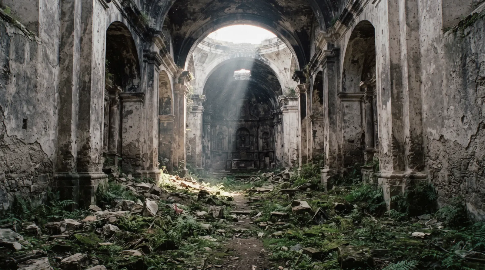
Quick answer What happened, what it ended, what remains
The Santa Marta earthquakes of 1773 broke the capital of the Kingdom of Guatemala. The cathedral was seriously damaged, the convents emptied, and the Spanish crown moved the capital away, the removal dated 1779-1780 in the cathedral's own record. What is left is the city you visit, a working parish inside a ruined cathedral, and convents that never reopened.
Key takeaways
- The cathedral record dates the damage to 1773 and the capital's removal to 1779-1780, a six-year gap most tellings skip, as the cathedral page sets out.
- La Merced survived practically new, having been finished in 1767, and remains open for worship today (La Merced).
- San Francisco was partly destroyed in 1773 and its ruins section was not rebuilt until 1967 (the city list).
- The Capuchinas convent was abandoned after 1773 by order of the Captain General, and its circular courtyard of cells survives (the city list).
- The park's fountain is 1737, by Diego de Porres, and it had already watched one capital fall (Parque Central).
The quakes that ended a capital
To understand what broke in 1773 you have to picture what stood there. This was the capital of the Kingdom of Guatemala, the seat of government for a vast captaincy general stretching across Central America. It was a city of convents, churches and royal houses two and a half centuries old by then, laid out on a grid and sitting between three volcanoes on ground that had never been still.
It had been shaken before. The 1717 earthquakes damaged San Francisco, and the San Casimiro earthquake of 1751 hit the city again, which answered by building itself a new City Hall. The warnings were on record.
The city built on anyway.
The event itself the sources this site verifies handle with care. They call the sequence the Santa Marta earthquakes of 1773, and they record its effect rather than its hours. The cathedral was seriously damaged.
The great convents were abandoned. The decision was taken to abandon the site altogether. That is the shape of it, and this page will not pad it out, because no verified source on this site gives a month, a day or a shock count for the sequence.
The name Santa Marta is what the record carries, and the record stops there.
The aftermath matters more than the shaking, because the aftermath is what you photograph. The capital moved away. The cathedral's own record gives 1779-1780 for the removal, which means the decision took years to carry out, and popular tellings that compress the quake and the move into a single year are skipping that gap.
The city declined into a market town, and that decline is precisely why the grid survives. Nobody built over the ruins. The plaza kept its 1737 fountain by Diego de Porres, the royal facades kept their long lines, and the broken churches kept their broken naves.
What reads today as a preserved colonial capital is, in a real sense, the wreckage of one that nobody got around to replacing.
The arc that led there, 1545 to 1773
The dates below are the ones the checked records agree on.
-
1545
The first cathedral is begun
The record of the cathedral block starts here, and the building it began never finished the fight with the ground.
-
1558
The royal houses are begun
The complex that held the treasury, the jail and the Hall of Arms, today the long facade facing the park.
-
1669-1680
The cathedral is rebuilt
Demolished on 7 April 1669, the second sanctuary was inaugurated and consecrated by November 1680.
-
1693
The arch is begun
A convent's covered crossing over the street, so cloistered nuns could cross unseen, the arch's own page carries the story.
-
1702
San Francisco is inaugurated
Diego de Porres's seismic baroque church, standing on a 16th-century fabric.
-
1717
The first big shake
San Francisco is damaged, an early warning the city did not act on.
-
1731-1736
The last convent rises
Capuchinas is built, its church consecrated 1736, the final convent founded in the city.
-
1737
The fountain is set
Diego de Porres sets the mermaid fountain in the plaza, verified at 1737, not the 1740 that circulates.
-
1743
A metropolitan see
The cathedral is elevated to a Metropolitan cathedral, the city at its height.
-
1749-1767
La Merced is built
Finished so late it was practically new when the ground broke.
-
1751
The San Casimiro earthquake
The second warning, the city answers by building a new City Hall.
-
1773
Santa Marta
The earthquakes seriously damage the cathedral and break the capital's tenure.
-
1779-1780
The capital moves away
The cathedral's record dates the removal here, the beginning of the city's second life as a ruin in use.
What the ruins were
The cathedral
The Santa Marta earthquakes seriously damaged the great church that had been rebuilt between 1669 and 1680 and elevated to a Metropolitan cathedral in 1743. In 1804 the parish of El Senor San Jose was created out of the ruins, and that arrangement is still what you see. The working parish occupies the rebuilt section, the rest stands open to the sky.
The ruins keep a crypt and passages whose usefulness is unknown, which is the record's own phrase, and the record leaves it there. Later shakes kept taking bites. The 1874 earthquake cost the parish its bell towers and the 1976 earthquake damaged the facade.
The conquistador Pedro de Alvarado was reinterred in his niche in the cathedral in December 2007. The full history of the block is on the cathedral page.
San Francisco and the pilgrim church
San Francisco's current church was built by Diego de Porres and inaugurated in 1702 on a 16th-century fabric, and it was damaged in 1717 and 1751 before the 1773 earthquakes partly destroyed it. The 20th century added its own damage in 1917 and 1976. The ruins section stood unrestored until 1967, while the 1702 church carried on beside it, which is why the site reads as two buildings in one.
Today the shrine of Santo Hermano Pedro, beatified in 1980 and canonized in 2002, draws thousands of pilgrims a year, so the church that broke in 1773 is now one of the busiest rooms in the city. It is covered in the city list.
The emptied convents
Capuchinas was the last convent built in the city, started in 1731 with its church consecrated in 1736 under Diego de Porres's supervision. It was damaged in 1751 and again in 1773, and after 1773 it was abandoned by order of the Captain General. Its most photographed feature is the circular courtyard, cells built in a ring around a central common chamber with underground passages, described by a visiting prince, Wilhelm of Sweden, in 1920.
The convent is owned today by the conservation authority CNPAG and access is paid, but no official fee amount is published online, so this site prints none. Read the full entry in the city list.
Santa Clara, and the honest gap
Santa Clara stands listed among the city's ruins on INGUAT's official Antigua page, and that is nearly the whole of the verifiable record. No official practical data exists for it at all, no fee, no hours, no closed days, because no official page is reachable. That is an honest gap, and this site prints it rather than filling it.
The pattern is worth noticing. The 1773 earthquakes emptied the convents, the capital's departure kept them empty, and two and a half centuries later the checked record for several of them is one line long.
The figures that do not agree
Start with the fountain, because it is the smallest dispute and the clearest example. The checked sources give 1737 for Diego de Porres's mermaid fountain in the plaza. The year 1740 circulates widely in guidebooks, and it is not confirmed by any source this site could verify, so this page prints 1737 and notes the dispute.
The fountain's exact day is unknown too. When a number is that cheap to print wrong, it is worth being the one site that prints it right, and the fountain itself still stands for you to check against the plaque in Parque Central.
The bigger simplification concerns the move. The earthquake is 1773. The capital's removal is 1779-1780, and that span comes from the cathedral's own record.
Compressing the two into one event is the most common error in popular tellings of the 1773 earthquake in Antigua Guatemala, so it is worth naming plainly. The destruction was the cause. The move was a decision, and decisions of state take years, which is exactly what the record shows.
If you read that the capital fled in 1773, you are reading a story that skipped the six-year gap, and the full sequence is laid out on the cathedral page.
Then there is the honest negative, which is the one that surprises people most. No verified death toll exists in the sources this site verifies. No shock count either, and no building-loss figure.
Popular totals for the Santa Marta earthquakes circulate freely, and none of them carries a verifiable origin, so none is printed here. That is not evasiveness, it is the correct treatment of an event this old with sources this thin, and it applies to the whole story told on this page. Where the record ends, the record ends.
Plan the rest of your visit with the planning guide and treat everything else you read about the quake's numbers with the same suspicion this page applies to its own.
Walking the ruins today
The ruin walk the quakes wrote for you fits inside the grid. Start at the cathedral on the park, where the working parish of El Senor San Jose sits against the ruined nave and the broken section stands open to the sky. Cross to the park itself and stand at the 1737 mermaid fountain with the long facade of the royal houses behind it, the complex begun in 1558 that held the treasury, the jail and the Hall of Arms.
Walk two blocks north to the arch, the convent crossing built from 1693 so cloistered nuns could cross the street unseen.
From the arch, continue to San Francisco, where the 1702 church still works and the ruins section beside it stayed unrestored until 1967. Finish at the La Merced complex, the building finished in 1767 that survived Santa Marta practically unscathed because it was practically new. It is still open for worship, and its story is on the La Merced page.
The whole loop is an afternoon's walk at an easy pace inside the grid, and the city list carries each stop with its hours where hours are published.
One honest practical line before you set out. Several ruin-site entry fees are simply not stated online. Capuchinas charges an admission whose amount no official page publishes, and for the cathedral ruins and Santa Clara the record does not even settle whether a fee is asked, so carry cash and expect to settle it at the door.
If you would rather hear the whole story in order without reading this page on your phone in the sun, the walking tour card is the lazy way to do it. You can find it among the tours.
The questions the ruins raise
What was the 1773 earthquake in Antigua Guatemala?
It was a sequence of quakes the records call the Santa Marta earthquakes of 1773. They seriously damaged the cathedral and broke the capital of the Kingdom of Guatemala, ending the city's tenure as a seat of government. The sequence and the aftermath are set out on the cathedral page.
Why did the capital move?
The destruction made the site untenable for a capital. The removal is dated 1779-1780 in the cathedral's own record, so the move followed the decision rather than the shaking, six years after the quakes. The full arc is on the cathedral page.
Which buildings survived?
The newest ones, above all La Merced, finished in 1767 and practically new when the ground broke. It suffered no major damage and remained open for worship. Parts of San Francisco's 1702 church carried on too, and both are covered in the city list.
Can you visit the cathedral ruins today?
Yes. The ruined nave stands behind the working parish of El Senor San Jose on the park, and you can walk into the broken section with its crypt and passages. Hours and fees are not published online, so settle them at the door, and the practical detail is on the cathedral page.
How many people died?
No verified figure exists in the sources this site checks. The totals that circulate carry no verifiable origin, so none is printed here. That gap is explained in the figures section above.
Why is the city full of ruins instead of rebuilt blocks?
The capital left after 1773 and the town shrank into a market town, so the broken churches stood as quarries and backdrops until conservation arrived. Nobody built over them, which is why the grid reads as a museum today. The stops are listed in the city list.
The city the quakes left
Three looks at the buildings that broke and the ones that did not.
Convento e Iglesia de la Merced, Antigua Guatemala
The church that was practically new in 1773 and came through Santa Marta standing.
Video: Henrry FigueroaWalking Tour of Parque Central in Antigua, Guatemala, Santa Catalina Arch & St. James' Day
The park, the fountain and the arch, the blocks the capital left behind.
Video: Chito's ChannelSANTA CATALINA ARCH (DETAILS IN THE DESCRIPTION)
A close look at the 1693 convent crossing that still spans the street.
Video: VidaAntigua . comVideos load from YouTube only when you press play.