 Antigua Guatemala City Guide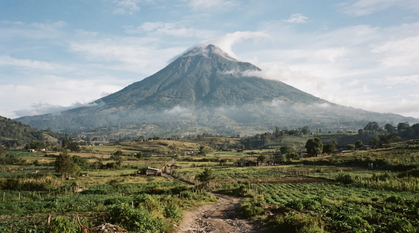
Volcán de Agua
Volcán de Agua is the extinct stratovolcano that frames every photograph of Antigua, standing over the city from the south-west. No official source publishes a status, fee, guide rule or trailhead for it, so this page refuses to describe the ascent as a plan. The history and the views need no permission. Start with what nobody publishes, the hiking near Antigua status board, or the Antigua Guatemala travel guide.
Quick answer What it is, is it open, the 1541 story, what to do instead
Volcán de Agua is the extinct stratovolcano of about 3,760 m (12,340 ft) that towers 5-10 km south-west of Antigua, named for the 1541 lahar that destroyed Guatemala's first capital, and protected since 1956 as a 12,600-hectare park. No official source publishes a hiking status, fee, guide rule or trailhead for it, and our check found no CONRED bulletin naming it at all, so this page will not describe the ascent as a plan.
Key takeaways
- The closure order of August 2026 named only Fuego and Acatenango, and Agua was not covered. But no authority publishes access rules for it either, which is exactly why no official answer exists. Track the current picture on hiking near Antigua.
- The free, honest ways to have the volcano are the photo hour from town rooftops and Cerro de la Cruz. The bookable volcano day-hike near Antigua is Pacaya, the one with a published framework.
- The name is the story. The 1541 flood buried the first capital and the survivors moved to the Panchoy valley, today's Antigua. Read the name and the 1541 flood.
Key facts
Opening hours
| No official gate or hours exist | not stated–not stated |
|---|
Closed Not stated. No authority publishes access rules for Agua, and no closure order names it either
Admission
- Adult
- No fee is published by any official source and none is printed here. There is no official ticket to buy, no published guide requirement and no permit system. The volcano cards on this page are Pacaya tours, the day-hike that is actually open
Planning it
- Time needed
- A photo hour from town needs nothing booked. No summit timing is printed, because no official route document exists to time it against
- Address
- Volcán de Agua, between Santa María de Jesús and Ciudad Vieja, departments of Sacatepéquez and Escuintla, 5-10 km from Antigua
What a Volcán de Agua visit costs
Two rows with prices and two authorities worth knowing, from our own checks of the official sites and the tour listings. The Agua lines stay empty rather than guessed, because no official source was reachable to set them.
Are you looking for a ticket to buy, or the reason none exists? No official source publishes an Agua entry fee, guide rule or permit, so the only priced rows here are the volcano day-hike that is actually open, Pacaya, priced exactly as its listings do.
| Option | Price | Includes | Cancel | Book |
|---|---|---|---|---|
| Volcán de Agua accessThe authority whose alert levels govern volcano access in Guatemala. It publishes no Agua status at all | No CONRED bulletin names Agua in our check, no INGUAT or park statement was reachable, so there is no published fee, guide rule or permit to list | Not applicable, nothing is on sale | Official site | |
| Foreign-advice position on AguaThe foreign-advice check behind our safety framing. It carries no volcano-specific guidance | No advice against volcano climbing on the FCDO page as of our check, and no Agua-specific line either | Not applicable, informational only | Official site | |
| Hike to Pacaya Volcano from Antigua, Voyageur ToursThe honest volcano day-hike from Antigua, the only one with the true all-in on the card | Listed $35 + $55.50 mandatory extras = $90.50 all-in | Shared round-trip transport, hotel pickup where listed, bilingual trail guide. The extras cover the Pacaya park entry fee and local fees | Free cancellation up to 24 hours before | Check Availability |
| From Antigua: Pacaya Volcano Tour, Volcano ExpeditionsThe classic Pacaya group departure, in English or Spanish, marshmallows on the steam vents | Listed $23 | Shuttle from Antigua, live guide in English or Spanish, marshmallow stop. The listing does not state the entry fee either way | Free cancellation up to 24 hours before | Check Availability |
Agua has no published prices to list, so none is printed. Pacaya figures come from the listings, read in Q3 2026.
Volcano day-hikes you can actually book
No Agua product is sold on this page, because no official framework exists to sell it inside. These two cards are Pacaya, the volcano day-hike that is open, priced as listed.
 from $35
Hike to Pacaya Volcano from Antigua
Voyageur's Pacaya hike: $35 listed, $55.50 of mandatory extras on top (park fee and transport) - about $90.50 all in. Read the price story before you book.
Check Availability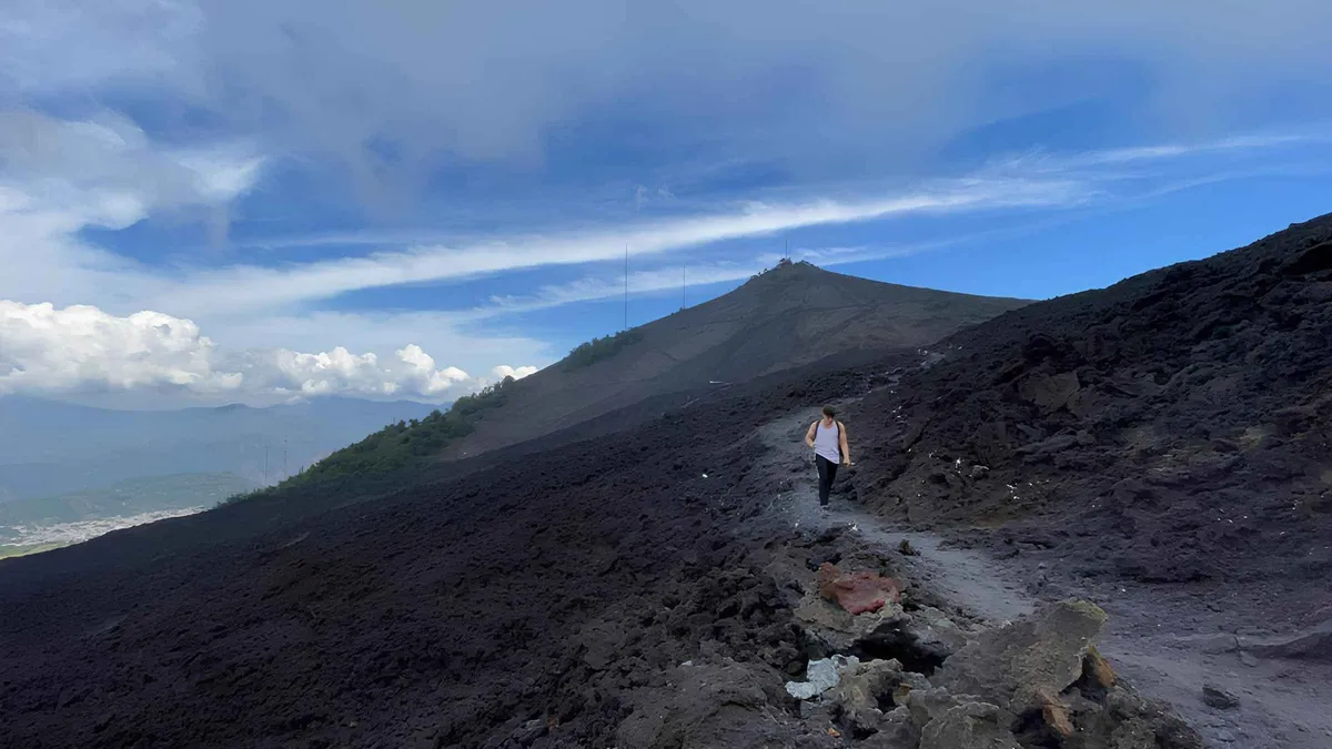 from $23
From Antigua: Pacaya Volcano Tour in English/Spanish
Half-day guided Pacaya hike with hotel pickup and marshmallows over the steam vents; the classic introduction to an active volcano, run in English or Spanish.
Check AvailabilityPrices, ratings and details are the platform's own. dollar figures are the listed prices — the platform bills in your account's currency.
What nobody publishes about Volcán de Agua
This is the spine of the page, and it is a negative finding. We went looking for an official answer on hiking Agua and did not find one.
Here is the whole check. Guatemala's disaster agency CONRED publishes standing bulletins on Fuego and Pacaya, but we found no bulletin naming Agua at all. The national tourism institute's site returned an error instead of a page, so no INGUAT statement was reachable. The protected-areas institute and the park authority were also unreachable, their domains refusing automated access on the day we checked. The country's own protected-areas declaration for Agua dates to 1956, but no current access document sits behind it online. The UK foreign-advice page, our standing safety reference, carries no volcano-specific line and nothing about Agua.
So the finding is plain: no official status, no published access rule, no published fee, no published trailhead. Nothing anywhere in the official record answers the question every visitor asks. Even the altitude has no arbiter. The figure most often quoted is 3,766 m, but the national seismology institute was unreachable on the day we checked, and the Wikipedia and Wikidata records settle on about 3,760 m (12,340 ft), so that is the number this page prints. What does that mean in practice? Anyone selling an Agua summit trip today is working outside any published framework we can verify. There is no fee schedule to check their price against, no gate hours to hold them to, no named managing body to complain to.
Community reports do circulate. People repeat stories of robbery risk on the upper trail and of guide-or-police-escort customs at the villages. Some of that may well be true. But it is not citable under this site's rules, so we report its existence and stop there. We will not print it as fact and we will not print a number with it. The same caution that keeps Fuego and Acatenango off this site as bookable products applies here with extra force, because where Fuego and Acatenango at least have closure orders, Agua has silence. Read our wider safety and scams framing before deciding what to do with your volcano day.
The name and the 1541 flood
The cone's history explains both its name and the location of the city you are standing in.
The Kaqchikel name for the cone was Hunapú, which means place of flowers. The Spanish renamed it Volcán de Agua, the volcano of water, after the disaster that made it famous. On 10-11 September 1541 a lahar, a wave of mud and water, swept down from the cone and destroyed the first capital, Santiago de los Caballeros, whose site is today's Ciudad Vieja. The newly installed governor Beatriz de la Cueva died in the flood. She had signed her documents only days earlier as la sin ventura, the unlucky one, a phrase history has never let her take back.
The survivors made a decision that shapes your trip. They moved the capital to the Panchoy valley, and that city is the Antigua Guatemala you are walking through now. The grid of streets, the arches, the green cone at the end of the view, all of it follows from a mudflow nearly five centuries ago.
The geology answers the other common question. Agua is an extinct stratovolcano of the Central America Volcanic Arc. It was active roughly 80,000 to 10,000 years ago and has had no eruptions since, so the name water refers to a flood, not to any modern volcanic behaviour. The cone rises 5-10 km from Antigua and spans two departments, Sacatepéquez and Escuintla. It has been a protected area since 1956, covering 12,600 hectares, with coffee growing on the lower slopes. The other volcano days around Antigua, their statuses and their histories, sit on the day-trip shortlist.
How much time to give Volcán de Agua
Three real ways to spend time with the cone, none of which requires a published trail, because none exists.
The photo hour is the plan this page stands behind, and the sunrise version is the one photographers keep coming back to. If you want the volcano-day feeling with a published price and a running trail, the Pacaya substitute does that job honestly, and its numbers sit in the cost table. The summit row is deliberately absent from the routings, because no official route document exists to plan against, and we will not invent one.
| Routing | Time | What you get | Cost shape |
|---|---|---|---|
| Sunrise photo hour from town | about 1-2 hours | The cone catching first light over the rooftops, best from a rooftop terrace or the Cerro de la Cruz viewpoint | Free |
| Pacaya day-hike substitute | about 6-7 hours door to door | A live volcano, steam vents and black lava fields, the open alternative | Listed $35 plus $55.50 extras, $90.50 all-in on the Voyageur card |
| The summit, unbooked | not printed as a plan | Nothing we can promise, because no official route, fee or rule exists to describe | Not printed, no official source sets one |
The village trailheads: what we can and cannot confirm
Two villages sit at the mountain's flanks. Getting to them is easy. Saying what happens from there is not.
Santa María de Jesús sits on the Antigua side of the mountain and Ciudad Vieja lies in the valley of the old capital, with the cone rising between them. Those two villages are the ones every informal route description starts from.
What we can confirm is the transport. Chicken buses serve both villages from the terminal behind El Mercado in Antigua, and the village routes are the same ones locals ride daily. The mechanics of boarding, fares in cash and frequency are on our chicken buses page, which covers the lot.
What we cannot confirm is everything a climber would actually need. We cannot tell you which path is the route, because no authority has published one. We cannot tell you whether any fee or registration exists, because no fee or registration has been documented by any source we could reach. We cannot tell you whether guides are required, or what the gate hours are, because there is no published gate. Each of those gaps has a page in a proper park system. Agua has none of them online.
The community warnings that circulate deserve their own sentence. Stories of robbery risk on the upper trail and of escort customs at the trailheads are repeated often enough that visitors will hear them. They are real enough that people repeat them, but they are not citable under this site's rules, so this page reports their existence and stops there. If a future official source publishes an access rule for Agua, the hiking near Antigua board will carry it the week we can verify it.
Safety and the CONRED alert table
Volcano access in Guatemala follows CONRED's four-level alert system. Here is their own wording, plainly translated, and where Agua sits in it.
CONRED, the national disaster agency, runs a four-level public alert system that governs what a volcano day can legally look like. Green means normal activity continues. Yellow means be prepared to act on instructions. Orange means stay alert and be ready to move to safe ground. Red means evacuate. The August 2026 orange alert and the ascent prohibition are what closed the volcano days around Fuego and Acatenango.
Now the finding that matters here. Agua sits nowhere in that system, because CONRED publishes no bulletin for the cone at all. There is no status line to read, no colour to check, no level that would tell you green from yellow. That absence is precisely the problem. A monitored volcano with a green alert is a known quantity. An unmonitored cone with no bulletin is simply unknown, and we do not fill unknowns with folklore.
The general country frame, for context. The US advisory for Guatemala is Level 3, Reconsider Travel. Antigua sits outside the restricted zones the FCDO names, which are border strips in the far north-west, and the FCDO does not advise against volcano climbing. Emergency numbers worth saving: Police 110, Fire and Ambulance 122 or 123, and the tourist line ASISTUR at 1500, staffed around the clock with English spoken. Our fuller safety and scams page carries the town-level detail.
| CONRED alert level | What CONRED says it means | What it means for a volcano day |
|---|---|---|
| Alerta verde (vigilancia) | 'Se mantienen las actividades normales.' Normal activities continue | Hike on, check again the morning you go |
| Alerta amarilla (prevención) | People 'deben estar preparadas para actuar' and follow authorities' instructions | Expect access rules and short-notice closures |
| Alerta anaranjada (peligro) | Institutions and public 'deben mantenerse alerta… para evacuar a lugares seguros si es necesario' | Trails typically close or become access-controlled |
| Alerta roja (emergencia) | 'Es momento de evacuar', to the established shelters per the community plan | No hiking, evacuate |
Volcán de Agua in dated lines
From the geological record to our own source checks, the dates that matter.
-
c. 80,000-10,000 years ago
The cone's last active phase
Wikipedia, fetched for this page: active in the late Pleistocene, no eruptions since
-
10-11 September 1541
The lahar takes the first capital
A mudflow from the cone destroyed Santiago de los Caballeros, today's Ciudad Vieja, and killed governor Beatriz de la Cueva (Wikipedia, fetched for this page)
-
After 1541
The capital moves to the Panchoy valley
The survivors relocated, founding the city that is now Antigua Guatemala (Wikipedia, fetched for this page)
-
1956
Protected area declared
12,600 hectares across Sacatepéquez and Escuintla (Wikipedia, fetched for this page)
-
3-4 August 2026
Fuego erupts, neighbours restricted
CONRED's prohibition named only Fuego and Acatenango. Agua was not covered by it (Emisoras Unidas and Infobae, via facts-pack-2)
-
September 2026
Still no Agua bulletin
CONRED's September bulletins report Fuego and Pacaya. Agua does not appear (conred.gob.gt, read for this page)
Sources: the English Wikipedia article on Volcán de Agua, fetched for this page, facts-pack-2 for the 2026 alert record, conred.gob.gt bulletins. No reopening or status prediction is made anywhere on this site.
Do and don't around Volcán de Agua
Do
- Take the cone from a rooftop terrace or Cerro de la Cruz at sunrise, the light hits the crest first
- Book Pacaya if you want a volcano under your boots, it is the open one
- Check conred.gob.gt before any volcano day, alert levels move access
- If you visit Santa María de Jesús or Ciudad Vieja, go for the villages and the views, not for an unmarked trail
- Give Antigua's 1,530 m a night or two before any steep walking, the sun is strong up here
Don't
- Do not improvise the Agua ascent off a blog route, no official route, fee or rule exists to check them against
- Do not buy an Agua summit trip from anyone, no operator is working inside a published framework we can verify
- Do not repeat the robbery-risk stories as fact, they are unverified and this page prints them as folklore only
- Do not book Fuego or Acatenango, ascents are suspended since August 2026, operators still selling them are not the authority
- Do not hand anyone an Agua 'park fee', no official fee exists to pay
Distilled from the official-source checks in facts-pack-2 and the CONRED alert-level rules.
Five things most visitors do not know
Details that change how you see the cone, each with its source.
- The volcano named Agua is the one without eruptions. It has been extinct since the late Pleistocene, roughly 80,000 to 10,000 years ago (source: Wikipedia, fetched for this page)
- The capital you are staying in exists because of this cone. The 1541 lahar forced the move from Ciudad Vieja to the Panchoy valley (source: Wikipedia, fetched for this page)
- The cone has been a protected area since 1956, 12,600 hectares across two departments (source: Wikipedia, fetched for this page)
- The Kaqchikel name Hunapú survives alongside the Spanish one, and it means place of flowers (source: Wikipedia, fetched for this page)
- No CONRED bulletin has named Agua in our checks while Fuego and Pacaya get standing coverage, so the quiet cone is also the one nobody monitors in public (source: conred.gob.gt checks, facts-pack-2)
Volcán de Agua map: the cone and the city
The summit pin sits 5-10 km south-west of Antigua, on the ridge between Santa María de Jesús and Ciudad Vieja.
Next stop around the cone
Pairings that work with a cone day, none of them a climb.
Cerro de la Cruz
The hillside viewpoint over the colonial grid with Agua behind it, the classic photo pairing. See Cerro de la Cruz for the walk up.
in townPacaya volcano
The volcano day-hike that is actually open, with the honest all-in price on its Pacaya page.
the open oneHobbitenango
The ridge-top eco park whose lookouts put Agua at eye level across the valley. Details on Hobbitenango.
about 20 min driveMonterrico
From the cone to the black-sand turtle coast, the other full day on the shortlist. Plan it on Monterrico.
the coast dayMore day trips
The full day-trip shortlist with shuttle times and honest costs lives on day trips.
the shortlistVolcán de Agua questions
Can you hike Volcán de Agua?
No official answer exists. No status, fee, guide rule or trailhead is published by any authority we could reach, so this page does not describe the ascent as a plan. The open volcano day-hike is Pacaya, priced on the Voyageur card, and the full finding is at what nobody publishes.
Is Volcán de Agua active?
No. It is an extinct stratovolcano, active roughly 80,000 to 10,000 years ago with no eruptions since, per the Wikipedia article fetched for this page. No CONRED bulletin names it either. The geology and the flood story are both in the name and the 1541 flood.
Why is it called Volcán de Agua?
The Kaqchikel name Hunapú, place of flowers, came first. The Spanish renamed it the volcano of water after the 1541 lahar that destroyed the first capital. The whole story is in the 1541 section.
What happened in the 1541 Volcán de Agua flood?
A lahar on 10-11 September 1541 buried Santiago de los Caballeros, today's Ciudad Vieja, and killed governor Beatriz de la Cueva. The capital then moved to the Panchoy valley, which is why today's Antigua exists where it does. Read the flood.
What happens if Volcán de Agua activates?
The geological record gives no recent activity to extrapolate, and CONRED publishes no Agua bulletin to read, so there is no honest extrapolation to make. What we can do is explain the monitoring case, which is the four-level alert table in safety.
How much does it cost to climb Volcán de Agua?
No fee is published by any official source and none is printed here. There is no official ticket, permit or guide rule. The priced volcano cards on this page are Pacaya's, in the cost table.
Where Volcán de Agua fits in a trip
The cone is not a day of your itinerary. It is the backdrop to all of them.
Agua is laid out in the Antigua Guatemala travel guide as the fixed point every street was aligned on, and that is how to use it. Build one sunrise photo hour from a rooftop or the hillside viewpoint and let the cone do the work. If you want the flanks at ground level, pair the valley villages of Ciudad Vieja and Santa María de Jesús with the village buses and treat them as village days, not trailheads. Spend the volcano-day slot on Pacaya, the one volcano near Antigua with a published framework, a price and a running trail.
The rest of the week fills from the day-trip shortlist: the lake, the coast, the ruins in between. One seasonal note worth planning around. In the dry months, November to April, the silhouette is cleanest and the sunrise light is reliable. The rainy season wraps the cone in cloud most afternoons, so put your photo hour in the morning, per the climate record.
Volcán de Agua on film
Three looks at the cone and its flanks, none of them a summit claim.
Destination Volcán de Agua Guatemala HD
A tour of the cone's slopes and the villages at its foot.
Video: We are AlangieVolcán de agua, Guatemala ¡más alto!
The flank country up close, coffee slopes and the villages below.
Video: We are AlangieEl "mal paso", Volcán de Agua
The notorious upper section the climbing folklore talks about, filmed on the ground.
Video: GO2GUATEVideos load from YouTube only when you press play.
Prices, hours and terms are set by the venue or operator and confirmed at checkout.
We may earn a commission if you book through one of our links, at no extra cost to you. Full affiliate disclosure